ERDENET MINING CORPORATION SOE
Complete aerial mapping, 3D modelling, DEM making, orthophoto generation has been done for the Erdenet mining corporation.
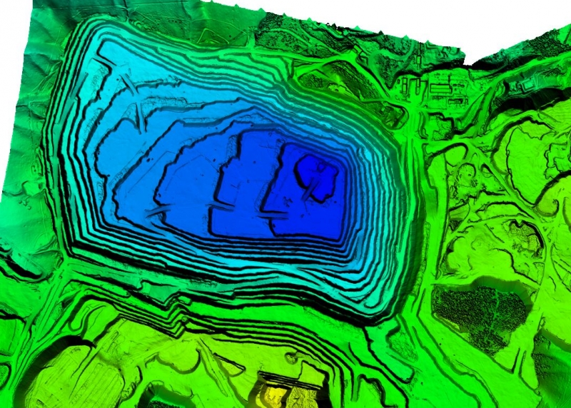
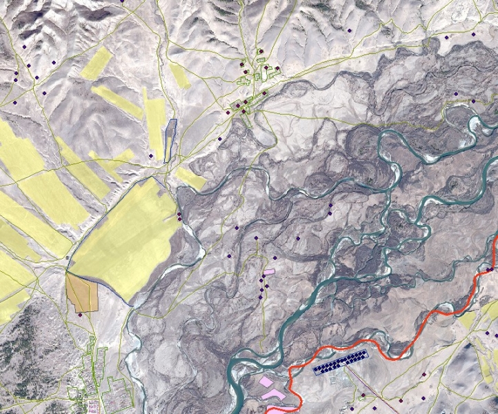
AERIAL MAPPING, MINING DUMP VOLUME DETERMINATION
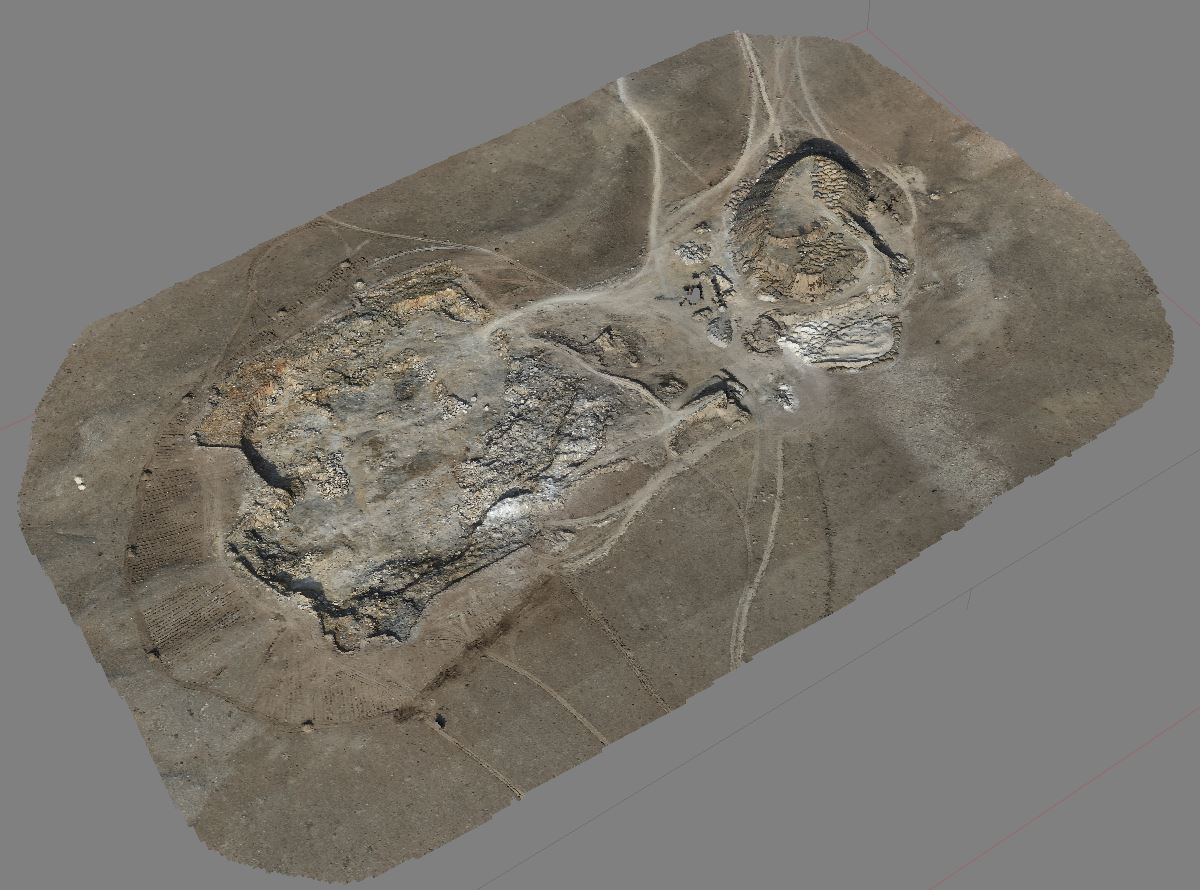
The mining dump volume determination and mapping of the limestone mine at Bayantsagaan sum located in Tuv aimag has been done using the Matrice 300RTK drone.
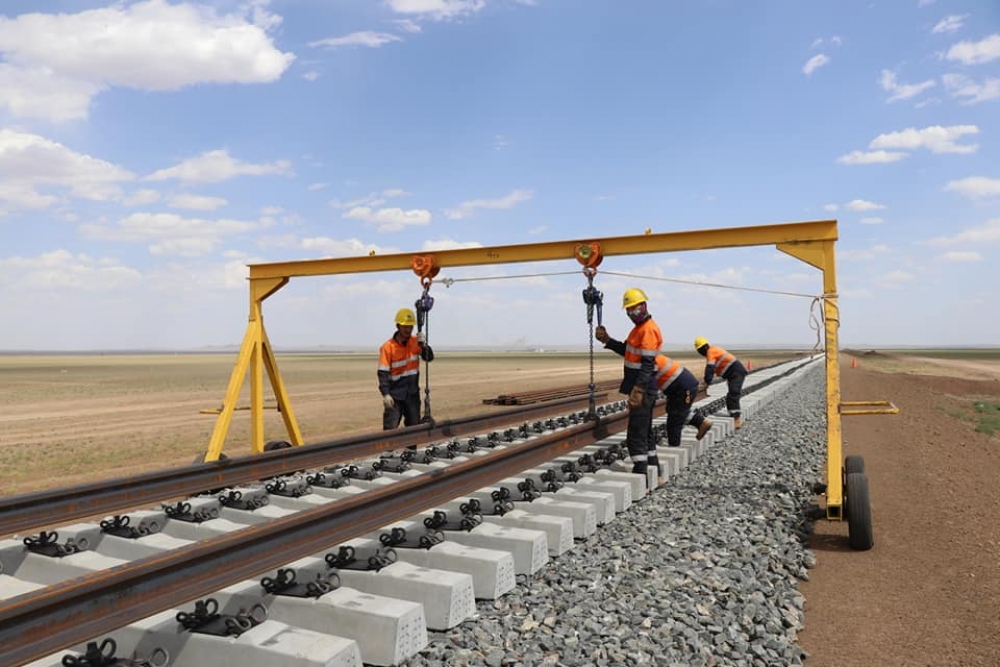
THE CONSTRUCTION OF THE TAVAN TOLGOI GASHUUN SUHAIT RAILWAY
From the January to November of 2020 geomatic surveillance has been done during the construction of the Tavan Tolgoi Gashuun Suhait railway.
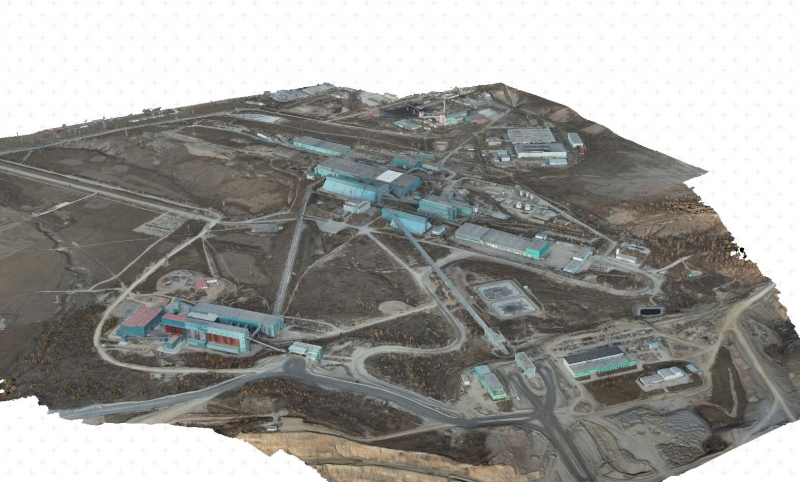
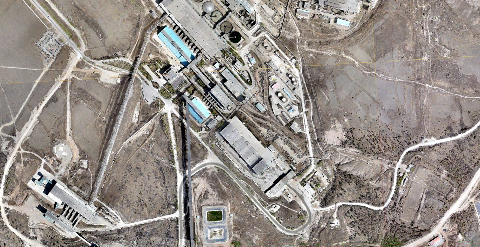
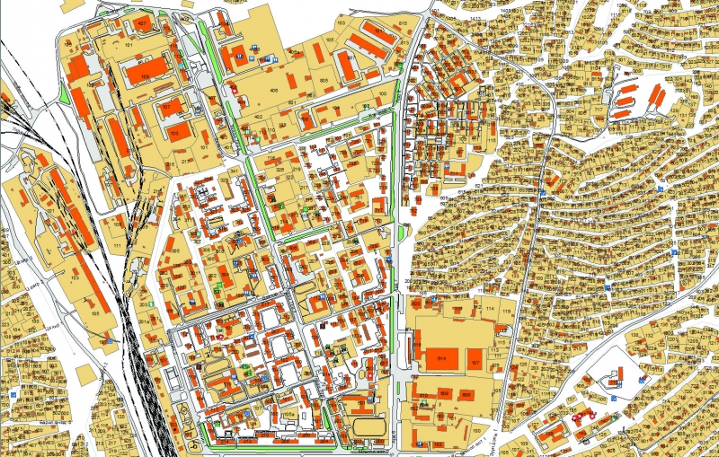
ENGINEERING UTILITY MAPPING FOR ERDENET MINING CORPORATION SOE
Our company has done digital surface model and orthophoto generation, 1:500 scale digital mapping, total aerial mapping of the 12000 hectare Erdenet mining corporation, engineering utility mapping and database generation for said utilities in 2020. Also as a part of this project we have verified the zones and re-calculated the elevation grid of the Erdenet mining corporation.
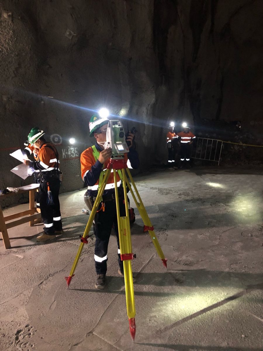
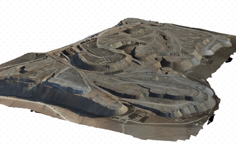
OYUTOLGOI PROJECT, CONSTUCTION OF THE INITIAL DEEP MINING CRUSHER
Our company has done various geomatic measurements during the construction of the initial crusher at 1350 meters deep.
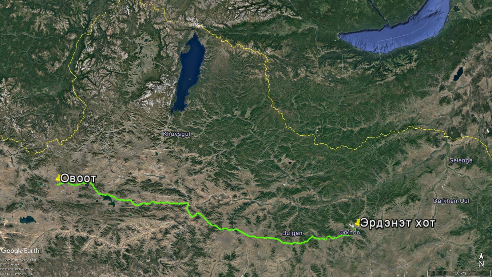
HEAVY-DUTY ROAD MAPPING
Mapping of the 545km long heavy-duty road from the Ovoot coal mine(Tsetserleg sum, Khuvsgul aimag) to Erdenet city has been done by the commission of Aspire Mining Limited and ICT Sain Consulting LLC.
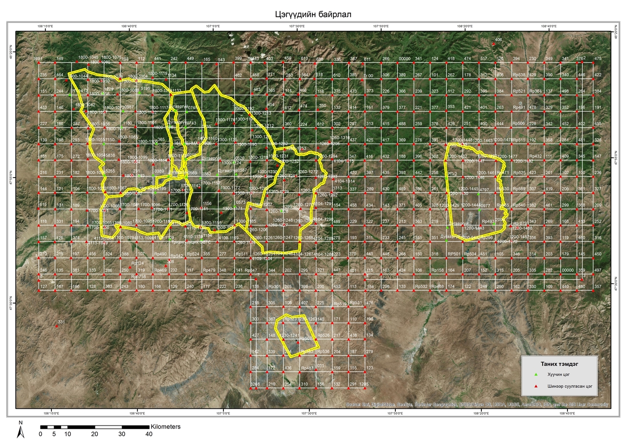
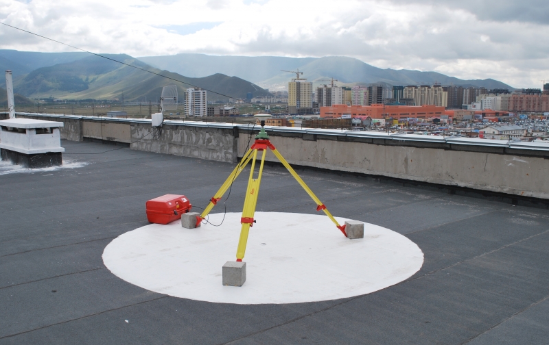
ULAANBAATAR CITY GEOID MODEL IMPROVEMENT PROJECT
As a part of the "Ulaanbaatar city geoid model improvement project" our company has installed 583 different surveying points with 6km between them in a grid as shown in the picture. Using those we have done highly accurate location, elevation and gravimetric elevation measurements.
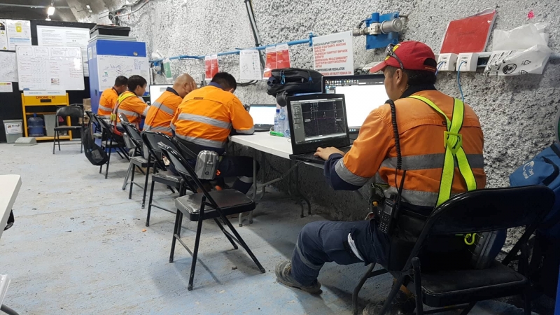
OYUTOLGOI PROJECT
By the commission of GCR Mongolia LLC our company has done daily surveying measurements at the construction site of the 2,4,5th mining shafts and other infrastructural buildings.
_715x536.jpg)
ULAANBAATAR CITY'S NEW INTERNATIONAL AIRPORT
From 2013-2017 our company has been the main surveying contractor for "Ulaanbaatar city's new international airport" being built at Khushugiin valley, Sergelen sum, Tuv aimag. We have successfully completed daily measurements, earthwork calculations and all other surveying measurements during the construction of the airport.
In 2017 the mapping of the1150 hectare airport area has been done according to the БНбД 11-08-06 guideline and has been successfully submitted to the client and the national surveying grid database.
ROAD MAPPING FROM CHOIBALSAN CITY TO KHALKH GOL SUM
As commissioned by ICT Sain Consulting LLC, 1:1000 scale digital mapping was done for the 175km long road from Choibalsan city of Dornod aimag to Khalkh Gol sum.
1:25000 SCALE DIGITAL MAPPING OF THE FLOOD AREA OF SHUREN HYDROPOWER STATION
By the commission of the Mongolian Energy Ministry, the 1:25000 scale mapping of the flood area of the Shuren Hydropower Station has been completed using stereo satellite imagery for an area of 203 square kilometers.
In this job images from the СПОТ 6 satellite of the french "Astrium" company has been used.
ADDRESS DATABASE CREATION, ADDRESS MAP CREATION
Commissioned by the MCUD. The address database and map creation is done for Mongolia's 21 aimags, 330 sums and Ulaanbaatar city's 9 districts. This work is being done by using ArcGIS, developed by the american company ESRI, based on GMS.
STATIC GPS MEASUREMENT FOR THE VERIFICATION OF THE INFORMATION FROM THE "KOMPSAT 3/3А" SATELLITE.
Commissioned by the Korea Aerospace Research Institute(KARI) and INHWA Engineering. With the objective of verifying the information from КОМПСАТ 3/3А satellite, GCP point location and elevation measurement has been done from 2011 to 2016.
Other Projects
- Surveying measurements for the construction of the logistics center of Tavan Tolgoi
- Measurements for Oyutolgoi, deep mines and Main Repair Center projects
- Ulaanbaatar city's groundwater well and water pipe project
- Erdenet mining corporation SOE's district, open-pit mine and utility network 3D model creation, database creation
- Geomatic surveillance during the construction of the 260km long Gashuun Suhait Tavantolgoi railway
- Oyutolgoi, deep mine ore transportation and mining, transportation elevation engineering network
- Electrical supply contruction and installation project for the outer area of the Gashuun Suhait container lot
- Geomatic surveillance during the construction of the 260km long Gashuun Suhait Tavantolgoi railway
- Oyutolgoi, deep mine's ventillation system fan installation project
- Oyutolgoi, deep mine ore transportation and mining, transportation elevation engineering network
- Erdenet mining corporation SOE's underground utility network mapping, database creation
- Geomatic surveillance during the construction of the 260km long Gashuun Suhait Tavantolgoi railway
- Oyutologi project, construction of the initial deep mining crusher
- Daily surveying measurements for the Oyutolgoi project's shaft, road and infrastructural constructions
- Mapping of the 545km long heavy-duty road from the Ovoot coal mine(Tsetserleg sum, Khuvsgul aimag) to Erdenet city
- Digital mapping of the water route, renewed as a part of the "Altai-Taishir" water supply project, commisioned by the austrian company "Оестап"
- Mining dump volume determination and mapping of the limestone mine at Bayantsagaan sum located in Tuv aimag
- Daily surveying measurements for the Oyutolgoi project's shaft, road and infrastructural constructions
- 425km long 2-nd grade levelling
- Total mapping of the 1150 hectare area of the new international airport
- Address database and map creation for Mongolia's 21 aimags, 330 sums and Ulaanbaatar city's 9 districts
- Daily surveying measurements for the Oyutolgoi project's shaft, road and infrastructural constructions
- "Ulaanbaatar city's geoid improvement project" commissioned by the "Land Management Department of the Capital City"
- Address databse creation for Ulaanbaatar city
- Daily surveying measurements for the construction of the new international airport
- Static GPS measurements on 41 points as a part of the sateIlite calibration project, commissioned by NHWA Engiineering
- Address database and map creation for Mongolia's 21 aimags, 330 sums and Ulaanbaatar city's 9 districts
- Daily surveying measurements for the construction of the new international airport
- Address database and map creation for Mongolia's 21 aimags, 330 sums and Ulaanbaatar city's 9 districts
- 1:500 scale digital mapping of Erdene sum (Tuv aimag), commissioned by "Евроформ" ХХК
- 1:1000 scale digital mapping for the 175km long road from Choibalsan city of Dornod aimag to Khalkh Gol sum, commisioned by ICT Sain Consulting
- 1:500 scale mapping for the future construction of the Erdenet mining corporation's new pit water pool, commisioned by "Prestige" group
- Static GPS measurements on 30 points as a part of the sateIlite calibration project, commissioned by NHWA Engiineering
- Daily surveying measurements for the construction of the new international airport
- Address database and map creation for Mongolia's 21 aimags, 330 sums and Ulaanbaatar city's 9 districts
- Creation of the land registration system as a parth of the creation of Ulaanbaatar's land management system, commissioned by the Property Relations Agency of the Capital City
- Digital mapping of the Bayanhoshuu purification pipeline network as a part of the project by the Asian Development Bank
- Digital mapping of the road from Doloon Buudal to Khandgait
- Static GPS measurements on 12 points as a part of the sateIlite calibration project, commissioned by NHWA Engiineering
- Commissioned by the Civil Aviation Authority of Mongolia, creation of Mongolia's Zone 1 obstacle database, following the international ICAO standard
- Verification of MONREF-97 GPS network
- 1:25000 scale mapping of the flood area of the Shuren Hydropower Station, commisioned by the Mongolian Energy Ministry
- Digital mapping of 2600 hectare area for civillian use, commisioned the government
- GPS network measurements, digital mapping, dump volume determination for "Shariin Gol" coal mine
- 1:1000 digital mapping for 200 hectare shipping yard construction area, 1:5000 scale digital mapping for 7800 hectare water pump area to Sainshand, as a part of the "Kherlen Gobi" project
- Mapping of 9055X Khutiin Khonhor located at Bayanjargal and Gurvansaihan sum(Dundgobi aimag), commisioned by Big Mogul Coal & Energy LLC
- Mapping of the 135km road from Khutag-Undur sum(Bulgan aimag) to Teshig, Baga Ilenkh, commisioned by "ICT Consulting"
- 1:500 digital mapping of the water transportation route at Taishir sum(Gobi-Altai aimag) as a part of the "Altai-Taishir" project
- Digital mapping of the 212km road from Ulziit sum(Bayanhongor aimag), commisioned by "ICT Consulting"
- 1:500 scale digital mapping of the 4054 hectare area for university campus construction at Baganuur district
- 127km overhead power line route planning, from Bayanlig sum(bayanhongor aimag) to Shinejist sum
- Mapping of the airport at Tsetserleg sum(Khuvsgul aimag)
- Digital mapping of the 120km, 12000 hectare railway area from Dalanzadgad city to Sainshand(Dornogobi aimag)
- 1:2000 scale digital mapping of the 1490 hectare are of the "Tevshiin gobi" coal mine at Saintsagaan sum(Dundgobi aimag)
- 187km geological survey profiling at Khurimt, Tsetserleg sum(Khuvsgul aimag), commissioned by "Aspire-Mining"
- Daily surveying measurements at "Ukhaa khudag" power station at Tsogt-tsetsii sum(Umnugobi aimag)
- Digital mapping of the 29500 hectare area along the 295km road from Shinejist sum(Bayanhongor aimag) to Gurvan tes sum(Umnugobi aimag)
- Additional mapping of 115km long, 11500 hectare area from Shinejist sum(Bayanhongor aimag) to Gurvan tes sum(Umnugobi aimag)
- Digital mapping of the Khushuutiin coal mine at Khovd aimag
- Digital mapping of the Olon ovoot mine at Umnugobi aimag
- Overhead power line route planning at "Ukhaa khudag" coal mine at Tsogt-tsetsii sum(Umnugobi aimag), dumping zone mapping, coal processing plant surveying measurements, general planning at Tsogt-tsetsii sum
- Digital mapping of 2300 hectare area at "Shariin Gol" coal mine, mining dump volume determination
- Mapping, surveying of the 184km overhead power line route from Baganuur to Choir
- Digital mapping of the "Khuut" coal mine at Bayanjargal sum(Dundgobi aimag)